Berry Bay to Badangi reserve walk
Coastal walk from Waverton Peninsula Reserve to Badangi
Reserve Aboriginal historical Protected native bushland and spectacular harbour
views.
We start our walk from the front entrance of
Waverton station a suburb and train station with small village like charm we
turn left and start walking down bay road. On the opposite side of bay road is
the Botanical garden café a nice place to sit back and relax to enjoy a meal in
the shaded outdoor garden setting and dining area before traveling on an
average meal here will cost between 10 and 16 dollars with a drink. 50 meters
from the station there is another smaller café the bay café that serves meals
and drinks with table and chairs undercover on the footpath. We keep walking
down bay road until we reach Woollcott street here is where you can make a
choice either do the bush walk through balls head reserve first all the coastal
walk along Berry’s bay. I have chosen to do the coastal walk first today so we
turn left into Woollcott and then right into Larkin Street beside Waverton
Park, a good place to stop and rest with a covered sitting area and public
toilets. We continue until we reach the junction at Wood Street on the left
hand side of the road there is a small stone wall labelled former Bp site and a
pathway leading to a viewing platform that overlooks Berry’s Bay and the city
harbour. Along the way, we stop to learn about the former Bp site from the
information board on the pathway. Bp Australia formerly occupied this site from
the early 1920s to 2002 the new parkland opened for public use on the 12 march
2005 to learn more North Sydney nsw.gov 
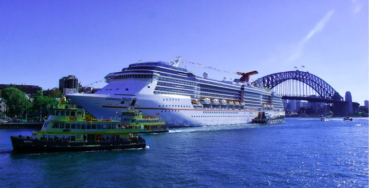
From the observing platform overlooking Berry’s Bay, view
Sydney Harbour Bridge peeping over Lavender bay and Centerpoint tower touching
the clouds. There are three main observing platforms on this part of the walk
each one giving the viewer a different angle overlooking Sydney harbour. The
next stop is the will Ashton lookout named in honour of a well-known artist and
Waverton resident. Here we can See Sydney Opera house peeping over Blue point
reserve. In addition, on the last viewing tower the Opera house appears a lot
closer.

The First lookout near Waverton park

At the end of the first look out Sydney harbour and Centerpiont tower
From here, we go across Larkin Street and follow the stairs
below the units on the right hand side until we reach balls head Road we turn right
then we turn left after the sign to Balls head reserve. Ball heads reserve a
bush land oasis overlooking Sydney harbour and Goat Island with many
bushwalking tracks and picnic areas you can journey into aboriginal past or
take a stroll through an Australian red gum forest to learn more. At the front
entrance of Balls, head reserve we follow the left hand side of the road
through a dark cool interior created by the forest canopy and surrounding bush
land until we reach a set of stairs. Walk down the stone stairs and turn right
walk along the road about 100 meters until we come across a small bush track.
As we walk through this Australian bush forest we can hear the waves gentle
smashing into the rocks we spend time admiring the native bush land and peering
through the dense vegetation getting the occasional glimpse of the ocean view
of Berry Bay. This bush track follows alongside the cost line in some places
the track gets very close to some steep declines, if traveling with children it
is advisable to be careful with your supervision. We continue along the track
until we come across an open cave with fabricated supports a good resting area
to enjoy the serenity of this isolated place in the middle of the city.

After the unique rock formation, the track leads to a
clearing that follows the fence line into another narrow pathway with
distinctive rock formations and trees grasping for life clinging to the
smallest amount of soil on the cliff edge for survival. Keep traveling and you
come across more rock formation and sand stone boulders ferns and native shrubs
until you reach stairs going up the mountainside.

At the top of the stairs, you will find a picnic area and a
plaque dedicated to the local children who attended the bicentennial picnic
24th July 1988. After the plaque follow the sign leading you to the Isabella
Brierley track this track runs along the western side of the reserve through
truly impressive woodland dominated by Red bloodwoods and Angophora. Emerging
back at the entrance into the reserve from here walk on the far right hand side
of the road along the path next to the Coal loader Conservation centre. View
the sign and site learn about Aboriginal rock engraving and native bush food.
Unfortunately, the rock engravings that are on this site are becoming harder to
see because of fading. We follow the road back to Horace Street at this point
there are three options stop rest either at the café, pats and catering and get
a nice cold drink or rest on the chair overlooking HMAS Waterhen and Balls head
bay or we can return to Waverton station.

Option three continues on walking, walk down the stairs with
HMAS Waterhen on our left hand side and units on our right the path leads to a
large grassy park and Oyster cove. The sugar mill that was once located here
was one of North Sydney’s earliest industrial areas operating for more than 100
years. First, it was the site of the sugar works reserve in the 1850s, later
converted to kerosene works in the 1860s. In 1917, the buildings then became
part of the Oyster cove gas works and ceased operations in 1983 only a remnant
of the buildings remains a brick chimney. In 1997, this area was gazette a
public park area.

From the edge of the grassy park, we enter the Badangi Reserve a great place to explore we walk up the stairs through a narrow pathway winding through two large stalls. We turn at the sign directing us to Wollstonecraft station and enter the beautiful Angophora woodland where the Sydney red gums have shed their old bark and the smooth red trunks are exposed. Beneath these tall towing trees is an understory of native shrubs and grasses. From the protected endangered woodland, we walk down a step sloop leading us into a cool dark shady gully as we approach we can hear the trickling of water. We walk over the bridge still listening to the water from the waterfall and follow the sigh to the Wollstonecraft Railway station.
There many different variations of this walk as you will
quickly learn once you start if you intend to take a different path as you are
walking there is no need to worry about getting lost. There are many signposts
giving clear directions and maps at the entrance of both reserves Balls Head
reserve and Badangi reserve so you can easily find your way and enjoy a great
time exploring.
Walk at a glance
Grade-Easy to medium (some small hills
and steps to climb)
Distance- Approximately
5 kilometres
Conditions- mostly shady
Time to
complete- about 90
minutes
The location and route of this walk can be found on the map at the bottom of this page
More walks
The location and route of this walk can be found on the map at the bottom of this page
More walks
Sydney's best coastal walk massive jagged sand stone cliffs and beach walk Coogee beach to Bondi Beach.
Sydney walk Sydney's 18th century sand stone building, monuments, art galleries, and museums
Sydney walk Sydney's 18th century sand stone building, monuments, art galleries, and museums
No comments:
Post a Comment